I returned to the Alabama Hills in the Owen’s Valley in early January. My favorite shots this time were in the grassy meadows on the north end of the area. I also enjoyed exploring around the boulders and rocks. One place I particularly wanted to visit was a spot called Boot Arch. Here are my five favorite shots from this part of the trip.
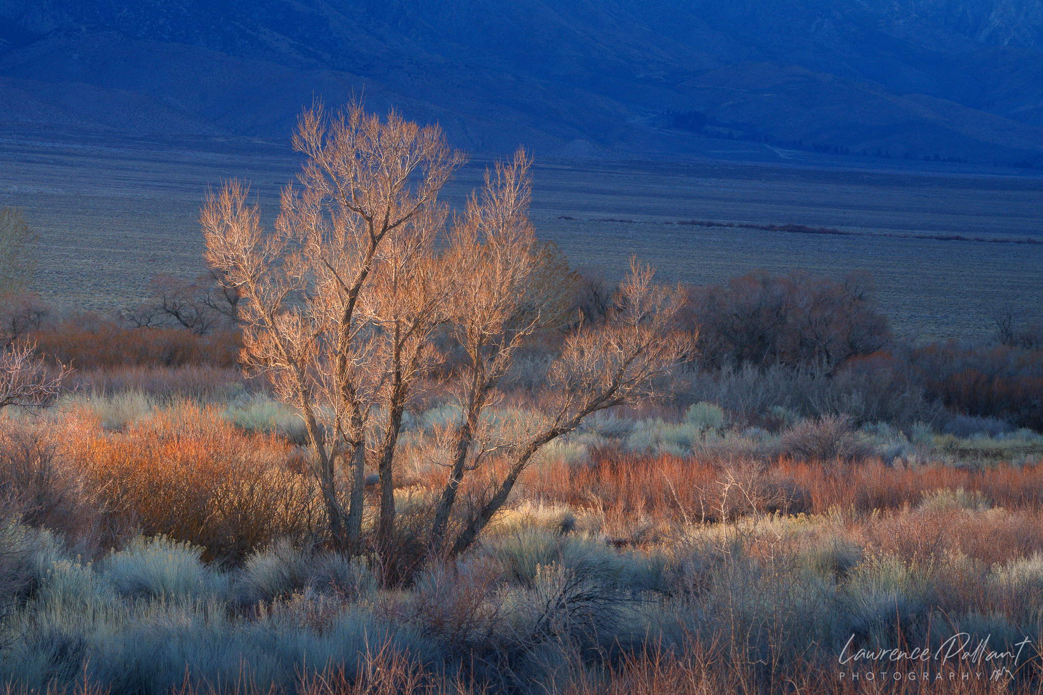
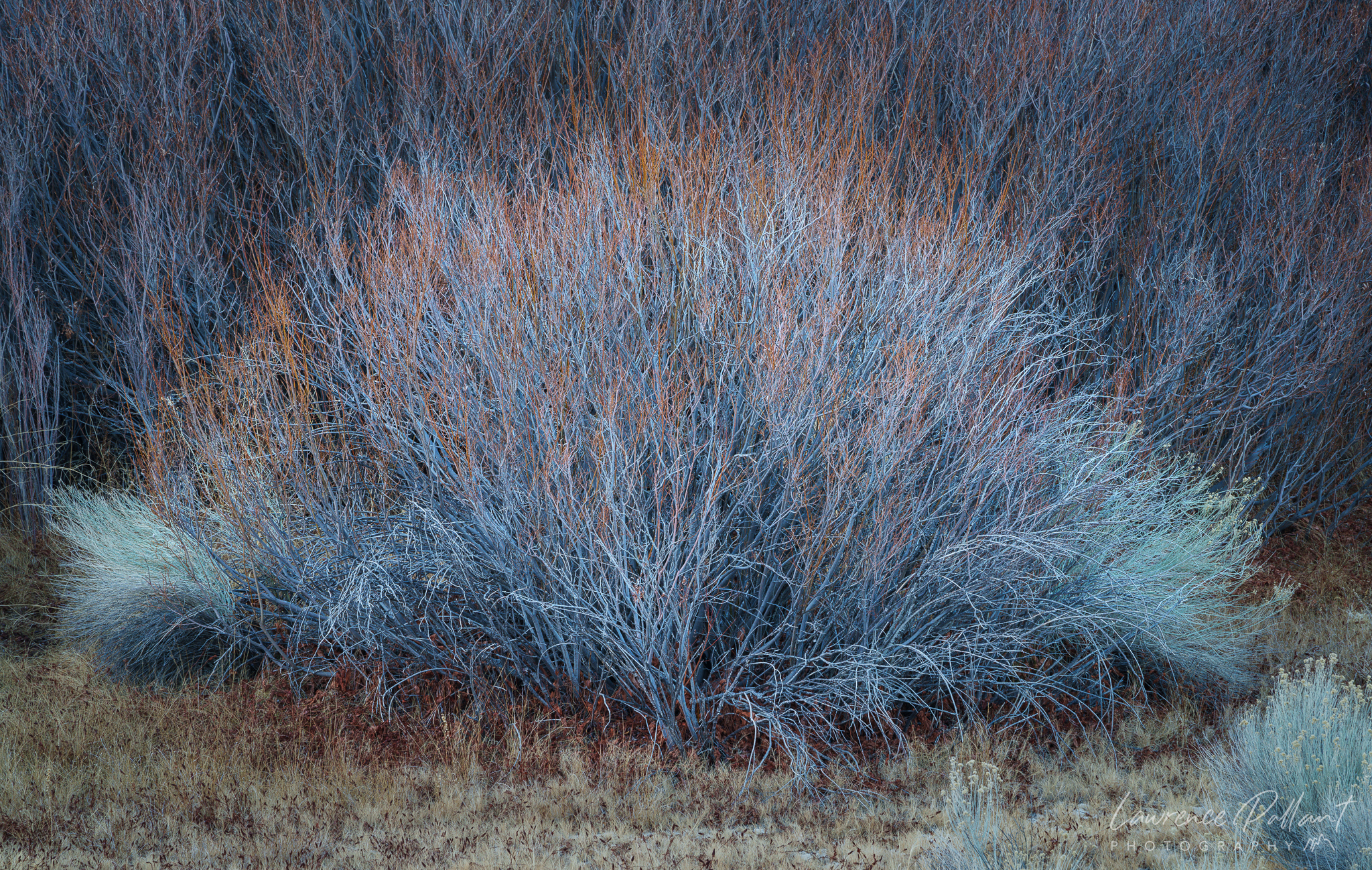
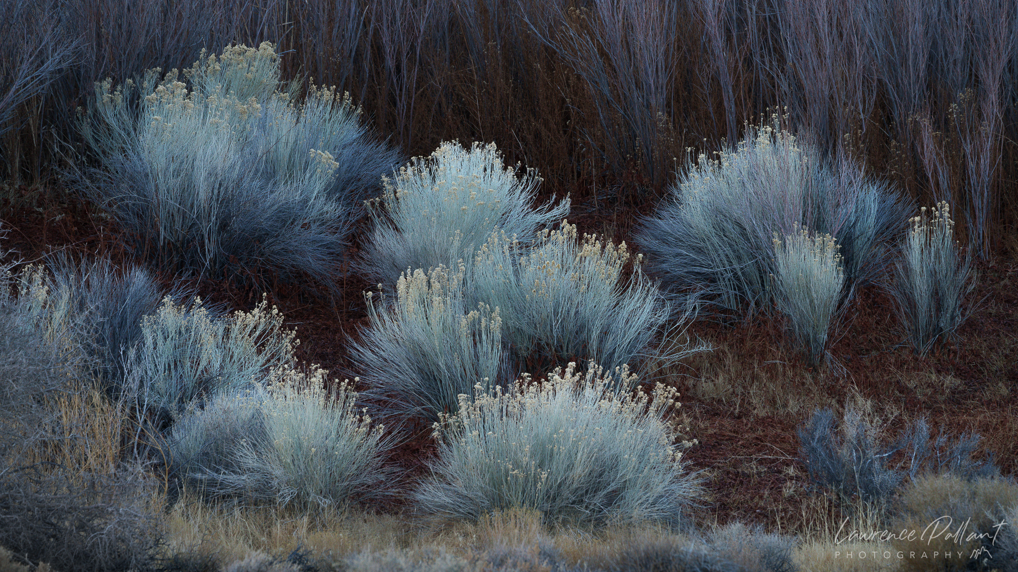
Splash of Light – I captured this scene just as the shadow of the mountains were about to extend over the meadow. I had to act quickly. A few seconds later the entire meadow was in shadow.Hairy Blue ThingBlue Tails
I like to shoot places in the early morning, often arriving before sunrise to witness the soft light as the sun rises. In these situations, I often explore a place the afternoon before. That’s what I did here, at Boot Arch in the Alabama Hills.
Boot Arch Panorama
I continued this trip with a visit to Mesquite Dunes in Death Valley during a dust and wind storm.
Last month, I took a short trip to the Eastern Sierra. Originally, I planned to spend the week at Death Valley National Park, but I decided to stay in Lone Pine for the first night—and it turned out to be one of the best decisions of the trip. I ended up capturing some of my best photos of the year.
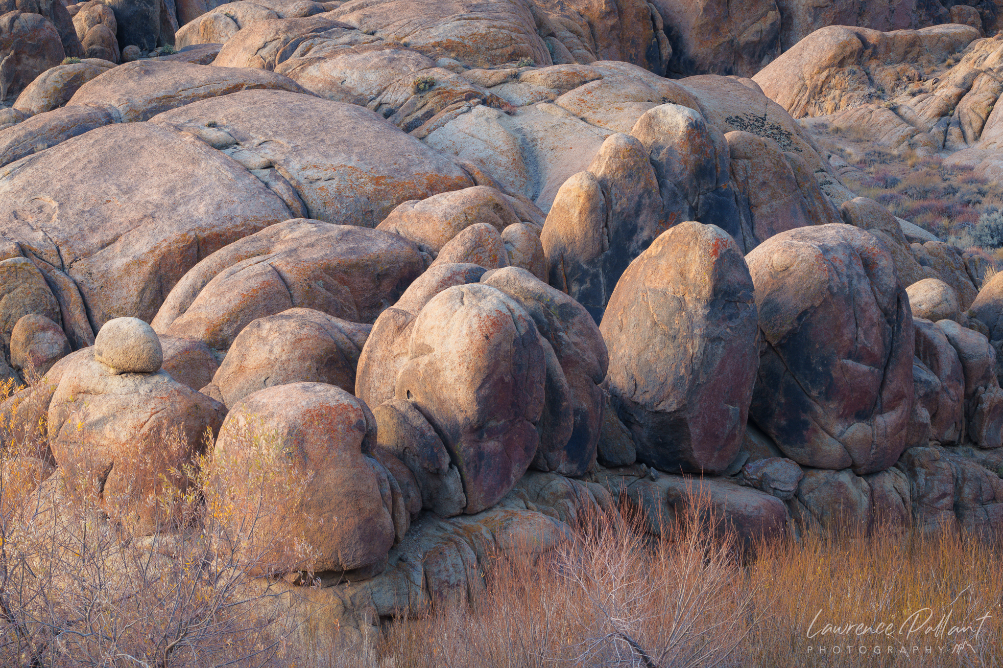
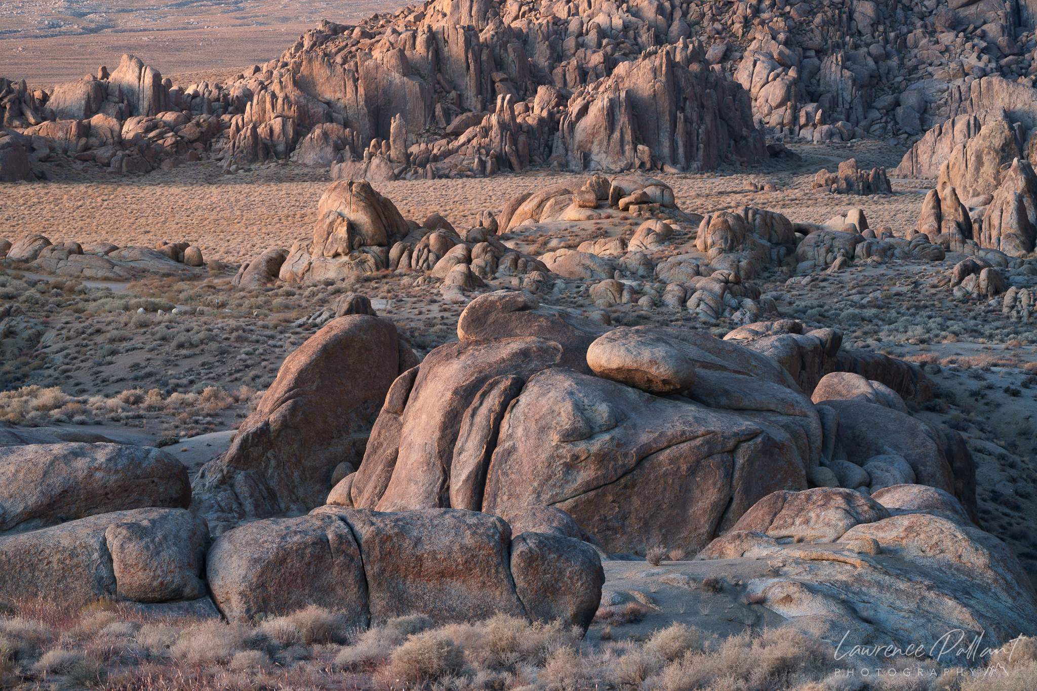
I had intended to shoot the Sierra crest around Mount Whitney as it lit up with the pre-dawn glow. But what I discovered instead was the Alabama Hills, bathed in a beautiful, soft light. I was especially drawn to the rounded boulders, which seemed almost out of place with their smooth, spherical shapes. I’d photographed these boulders before, but the harsh light at that time hadn’t done them justice. On this morning, however, the thin cloud layer on the horizon gave the sunrise a soft pink glow, creating an ideal atmosphere for the shot. Inspired by this scene, I decided to turn it into a long-term project, which I named “Lost Marbles.” The project focuses on capturing images of rounded, seemingly misplaced boulders in nature.
Below, I have included six of my favorite photos from this trip, which included a short visit to Death Valley National Park. To view the full collection of photos from this trip, go to the gallery on my website.
Lost Marbles #2Lost Marbles #3Lost Marbles #4Boulder Castles
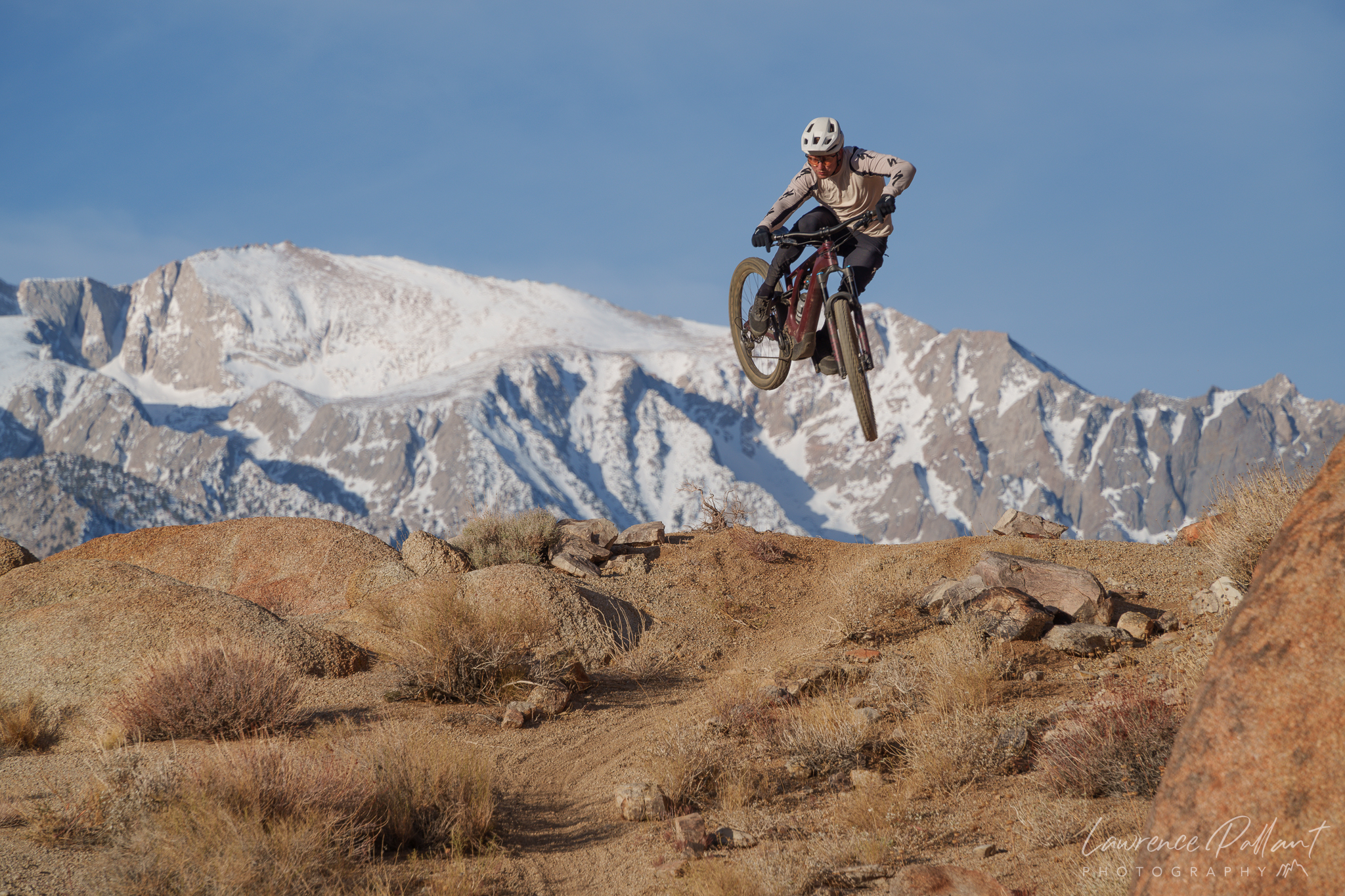
Before I left the Alabama Hills, I met two mountain bikers filming jumps with the Sierra Mountains as a backdrop. They let me join them with some shots!
Flying High
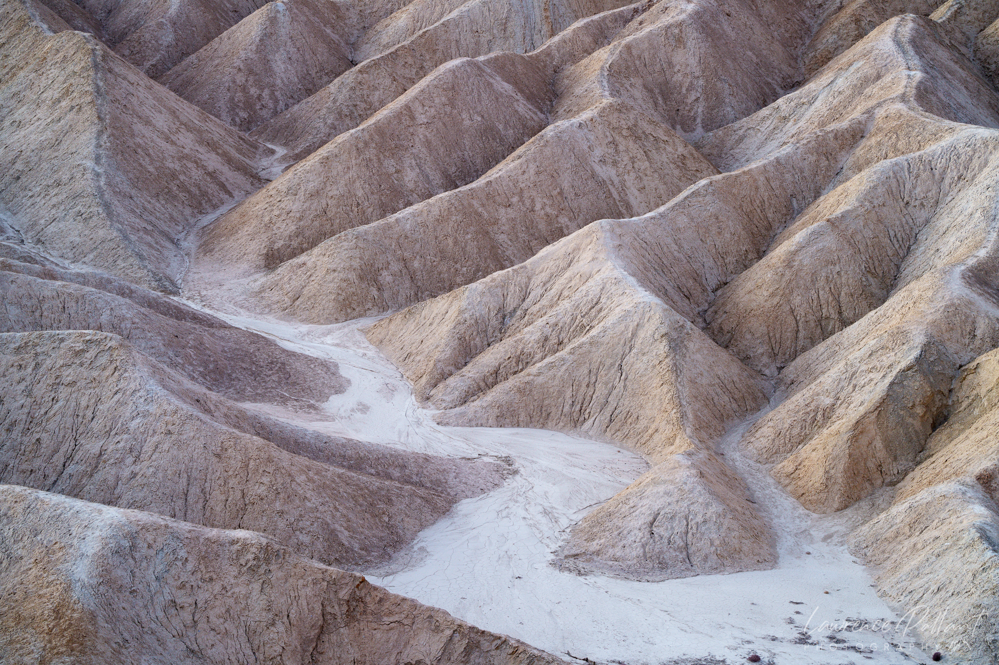
This last photo was take around Zabriskie Point in Death Valley National Park.